Exploring the Parks and Nature Areas Around Sioux Falls

Sioux Falls has 76 named parks throughout the city that range from small sites suitable for neighborhood gatherings and playgrounds to large well developed nature centers such as Great Bear Recreational Park, Arrowhead Park, the Wegner Arboretum and East Sioux Falls Historical Site, and the linked park system along the Big Sioux River. The state provides outdoor recreation areas and state parks including the Big Sioux Recreation Area, Beaver Creek Nature Area, Lake Alvin Recreation Area, Newton Hills State Park, and the Outdoor Campus in Sioux Falls that is a joint city/state operation.

Sunday, April 22, 2012

Great Bear: The Lower Trail and Up on the Ski Lift Hill


Great Bear is one of our most frequented hiking areas from April through the first serious snowfall in the late fall.  It is usually thought of as a winter park, but it is also one of the primer hiking opportunities within the Sioux Falls area for the rest of the year.

This city-owned park is located along Rice Street between Sioux Falls and Brandon and parallels the east flowing Big Sioux River. Going east on Rice Street, the park is clearly marked on the right side of the road, just past a rock/sand/gravel processing plant.  There is a long paved entrance road that leads up to the park; the first exit on the left leads to the archery range and the road continues to gravel parking lot that fronts a large wooden chalet that hosts the winter activities. The chalet is also used to host various gatherings for the rest of the year, including weddings.

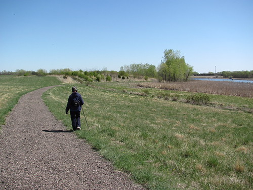
The Ralph and Doris Wallin Nature Trails system has a main route constructed of crushed asphalt that provides easy access for nearly anyone.  There are grass trails that spread out from that main trail so that people can take a more varied path.  In addition, there are trails that lead up onto the hills that loom over the main route.  In fact, there are three sets of hills that connect with the wide-spread web of pathways through the park. Map boards are scattered throughout the park, but without a clear notion of ordinal direction, they can be difficult to follow.

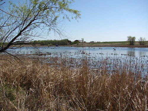
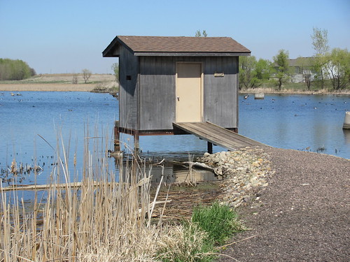
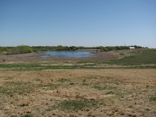
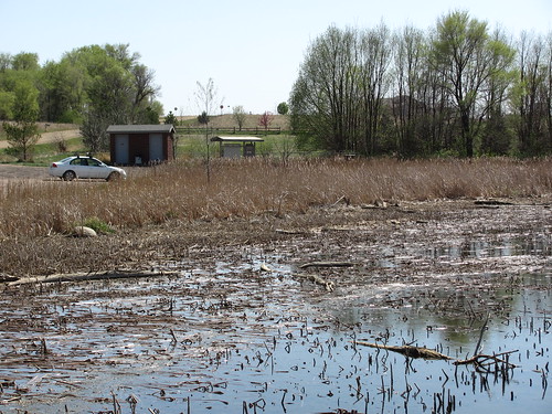
There is a large pond along the right side of the trail that leads into the wooded area.  This pond hosts a variety of life, including many turtles that are often seen sunning themselves on moss covered logs just offshore toward the end of the 
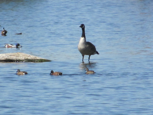
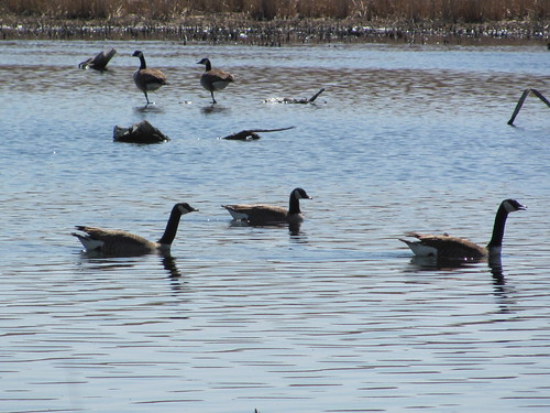
pond.  I have often seen geese and ducks on the pond as well.  Toward late summer, a large portion of the pond is covered in green algie, although there are a couple of aerators that keep the keep a portion of the pond clear throughout the year. The pond is one of the key interest area along the trail.

The main trail passes along the pond, but there is an alternative pathway at the head of the pond that leads the hiker into a tree-covered route on the opposite side, and this is the route that I usually take.

I like moving on natural surfaces if possible, although the improved trail is preferred when there has been heavy rain that makes the natural path muddy.

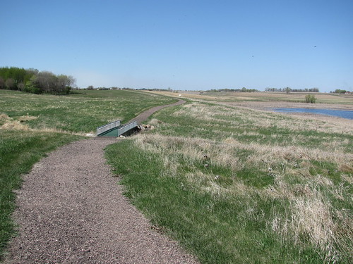
If following the alternative trail, the pathway continues on until reaching the first of several wooden bridges.  If going along the improved trail, the hiker turns to the right at a crossroad, just opposite a set of metal benches developed as part of a Boy Scout Eagle project.  Just past the first bridge, there is a pathway that leads up hill toward the ski lift summit.  This pathway is rather steep, but it is part of my regular hike.  It passes the ski lift machinery and continues along the rim of a steep hill overlooking part of northern Sioux Falls and the Big Sioux valley. 

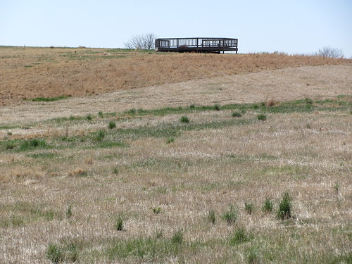
The path moves on to an overlook that provides a panoramic view of the city; a map board has been erected with prominent Sioux Falls landmarks indicated. This is really a great view and well worth the effort to climb the hill.

I noticed that, like many of our nature areas, home development seems to be in the future.  A sign at the end of this elevated section of the park advertises home lots for sale.  Again, I am so thankful that the city has acquired this property so that all citizens an enjoy strolling through wooded hills that have been preserved for the public.

Another steep pathway leads down off the hill, back to the valley with the main trail, providing a looping aspect to the hike up and down the hill. The trail continues into the woods for another few hundred yards until ending at one of the many benches.  I generally pass the end of this trail and double back on the opposite side of the ravine.  There is also a route up the second set of hills that leads through a meadow and back downhill to the continuing trail in the second valley.  This assent pathway is very steep, nearly straight up the hill. 

As the pathway returns to the crossroad, the main trail continues to the right and leads over other bridges deep into the second 
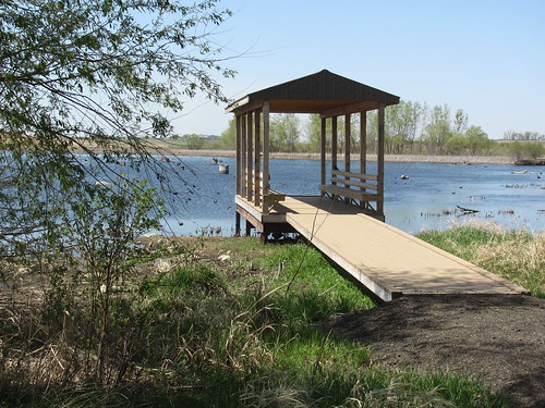
valley.  A roofed rest station is located at the end of this section of the main trail.  This is a nice quite spot to sit for a while and listen to the birds and the wind blowing through the trees.

On the walk back toward the chalet, just before the pond, there is another opportunity to climb up the second large hill, this one overlooking the parking lot, the chalet, and providing another panoramic view over northern Sioux Falls. 

On strolls through these trails, I have seen many types of birds, including hawks and turkeys.  I have also twice seen lone coyotes moving through, deer on several occasions, and once a skunk.   This is a wonderful spot for a stroll through the wooded areas and is another of the many outdoor gems within the Sioux Falls area.  It is one of our favorite hiking areas and is only a few minutes away from our eastside Sioux Falls home.  Most new hikers to this area just wander around the pathways the first few times to become oriented to the web of trails. 

For the complete set of photographs associated with this narrative, visit my Flickr page at: http://www.flickr.com/photos/jayheath/sets/72157629504889318/


Wednesday, April 11, 2012

Dewey C. Gevik Outdoor Conservation Area

IMG_1520.JPG
The Sioux Falls Argus Leader ran a story in their “Go Outdoors” section on Friday, April 6, 2012 featuring birding opportunities in the area, and one of the sites highlighted in that extensive article described the Dewey C. Gevik Outdoor Conservation Learning Area, a facility that was totally unknown to me. The following language is from the website describing this nature area (http://www.leifericson.org/sfbc/id22.html):
IMG_1518.JPG
“The Dewey C. Gevik Outdoor Conservation Learning Area consists of an area of 100 acres, managed by the Minnehaha Conservation District. It includes native prairie grass plantings, shelterbelt and wildlife tree plantings, volunteer native trees, and wetlands. The trail system offers access to all the diverse environments and includes observation areas to watch wildlife.”
IMG_1558.JPG
“For birding purposes, it offers areas for prairie, wetland, nesting, and migrating species, with access and observation areas for short of long-term observation. It is rare to find an area dedicated to nature that is wildlife friendly, does not allow any hunting or trapping, and will be taken care of for future generations.”
IMG_1556.JPG
Today, my wife and I decided to drive out to see the site and stroll along the trails. The learning center is located west of Sioux Falls; driving west along Highway 42 (12th Street), we continued past the Wall Lake turnoff, just past the Wall Lake gas station, to the first through gravel road and turned south for about one mile. The learning center is along the right side of the gravel road, just across from a long line of mailboxes and is clearly visible with a large sign and parking area.
IMG_1549.JPG
The central feature of the site is a large pond with adjoining wetlands, a crushed asphalt hiking trail that circles around the pond and through the prairie, and a set of three observation structures. There is also a set of vault toilets just off the parking lot.
IMG_1523.JPG
We passed through a gate and entered the trail that circles the area along the pond. Our first stop was an observation blind that is built upon a pier out into the wetlands. The blind has slit windows and a bench.
IMG_1525.JPG
After sitting there for a few minutes, the bird life that had been disturbed through our presence resumed its activity. There was a large number of waterfowl visible, mostly ducks and geese.
IMG_1534.JPG
On the website, there are 55 bird species listed that can be found at this site.
IMG_1547.JPG
Continuing on our hike along the trail, we moved to the far end of the pond and up on a rise where a bandstand-like structure had been built to afford a commanding view over the landscape.
IMG_1543.JPG
The trail then continued along the far end of the pond and on to the other side. The trail forked, one end moving along through a shelterbelt at the water’s edge and the other along an elevation overlooking the landscape from another vantage point.
IMG_1540.JPG
As we took the water’s edge trail, I moved through the trees to more closely observe the waterfowl cruising about.
IMG_1565.JPG
While the trail is developed in a loop form, the loop is not closed. In the end, the hiker must return along the same pathway, although there is both a lower and an upper element of that trail.
IMG_1566.JPG
By the time we had returned to the gate at the parking lot, we had walked about an hour and fifteen minutes. The trail is very well developed and it does not present any hiking challenge. There is interpretive signage located throughout the site. The point of the hike is to observe the prairie grasses and trees and the pond life, especially the avian population.
IMG_1555.JPG
From the parking lot, we walked over to another covered structure with benches and built on a pier over the wetlands. It seems designed for groups to attend to a guide pointing out features of the site. For us, though, it was a pleasant spot to sit back in the sun and watch the bird life.
IMG_1560.JPG
The Gevik learning area is a very pleasant spot just west of Sioux Falls. It seems a wonderful spot for a contemplative stroll through the prairie and along the shoreline of this large pond. This nature area is just on the west end of Wall Lake, so there are a number of residences visible in the near distance. It is fairly close to Sioux Falls, especially to those who live on the west side of the city. We will come back to this site over the coming seasons to observe the changing conditions. For people really interested in bird watching, this seems like one of the premier settings in the area.
IMG_1567.JPG
I read about another nature center along the same road but on the north end, north of Highway 42. On the way home, we continued along that road, past Highway 42, for another mile to the Makoce Washte Native Prairie. This is a parcel of land owned by the Nature Conservancy. We looked but were unable to find an entrance or anything resembling a hiking trail.